

It was elaborated the methodology, in order to obtain the updated land use/land cover map of the Romanian study area. The methodology consists in:
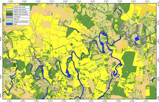
Land cover/land use map for the study area – unsupervized classification (Landsat 8 OLI) subset
Accessing and comparing of recent information relating to land cover / land use lead in updating and improving the quality of existing databases. Within a GIS system, through integration with orthophotos and / or satellite images can be achieved a better management and monitoring of agricultural and non-agricultural land in a territory.
The methodology for data assimilation of snowpack parameters in the hydrologic model NWSRFS and in the system for estimation of flash floods occurrence risk in Romania – ROFFG, was designed. The optimal values of the snow water equivalent resulted after the application of the data fusion procedure will be assimilated in a specific way, for adjusting the state parameters.
An important aspect that was taken into consideration is related to the fact that at the time when the water equivalent value simulated by the SNOW-17 model is changed, in an automatic way it is also changed accordingly within the NWSRFS systems the percent of snow cover at the hydrographic basin level.
The inventory and selection process was done for the software systems, modules and utilities that are needed for implementing the methodology of snowpack parameters assimilation in the operational hydrological forecasting models.
Using the selected software applications was started the implementation of scripts and programs for handling the export-import operations for the data flow, and for the specific processing steps for assimilating the snowpack parameters into the operational hydrological models NWSRFS and ROFFG.